


I. Introduction—Giving Drones Better Senses
Drones are being used in more and more industries. Delivery, powerline inspection, agriculture, and emergency work all rely on drones to move safely. Flying through complicated environments is not easy. Drones need to detect obstacles and understand the space around them.
Cameras, LiDAR, and ultrasonic sensors can help. But they often fail in fog, rain, dust, or low light. Shadows, glare, or sudden changes in light can make cameras unreliable.
Millimeter-wave radar offers a different solution. It uses high-frequency radio waves to detect objects, measure distance and speed, and sense direction. Unlike cameras, it works in poor weather and low visibility. When drones use this technology, they can fly more safely and handle more difficult missions.
Internal links:
II. What Makes mmWave Radar Special
Millimeter-wave radar is different because it combines range, accuracy, and weather resistance.
How FMCW Radar Works
Most drone mmWave radars use Frequency-Modulated Continuous Wave (FMCW) technology. The radar sends a signal that changes frequency over time. When the signal reflects off objects, the radar measures the frequency shift. This lets it calculate:
-
Distance to the object
-
Relative speed of the object
-
Angle or direction of the object
This information allows drones to know where objects are and how fast they are moving.
How It Compares to Other Sensors
| Feature | Camera | LiDAR | Ultrasonic | mmWave Radar |
|---|---|---|---|---|
| Range | Short | Medium | Very short | 0.2–350 m (U300) |
| Weather Resistance | Low | Medium | Low | High |
| Speed Measurement | Limited | Limited | No | Yes |
| Angular Detail | High | High | Low | Medium–High |
| Weight & Power | Low | Medium–High | Low | Low–Medium |
This shows why mmWave radar is useful for drones flying in cities, forests, or industrial areas. It works where cameras or LiDAR may fail.
External links:
III. Moving from 2D to 4D Radar
Older radar systems detect objects in two dimensions: distance and direction. 4D radar adds elevation and relative speed. This gives drones more information about the world around them.
Why 4D Matters for UAVs
-
It shows X, Y, and Z coordinates of objects.
-
It measures how fast objects are moving.
-
It can track several objects at once.
-
It provides point cloud data that drones can use for navigation and AI processing.
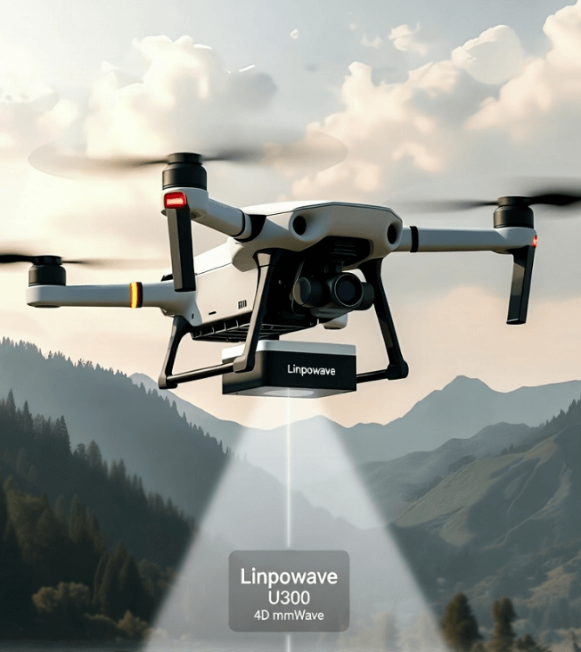
The Linpowave U300 is built for drones. It can detect objects from 0.2 to 350 meters away, measure distances with ±0.23 m accuracy, and cover ±40° horizontally and ±12° vertically. Its refresh rate is 20 Hz, fast enough for drones to react to changes in their environment.
Internal link: U300 Product Page
IV. How 4D Radar Helps in Real-World Drone Missions
Obstacle Avoidance in Low Visibility
Drones need to fly safely around buildings, trees, and wires. The U300 radar detects static and moving obstacles even in fog, rain, or darkness. This helps drones avoid collisions without relying only on cameras.
Terrain Following for Agriculture
Agricultural drones often fly low over uneven fields. The radar measures the ground level in real time. This helps drones maintain height, avoid crops, and spray evenly or take accurate images.
Precision Landing for Delivery
Drones delivering packages must land in tight spots. The radar helps them map the terrain and land safely, even without GPS.
Powerline Inspection and Infrastructure Safety
Drones inspecting powerlines need to see thin wires and tall towers. Multi-target tracking allows drones to spot these structures early, reducing the chance of collision and improving inspection quality.
Tracking Multiple Moving Objects
Urban drones or disaster response drones encounter moving objects. The U300 can track several objects at once. This lets drones navigate safely without human control.
Internal links:
V. Technical Details of the U300 Radar
The U300 radar is designed for drones, balancing performance, weight, and power.
-
Frequency: 76–81 GHz
-
Range: 0.2–350 m
-
Distance Accuracy: ±0.23 m
-
Field of View: ±40° horizontal, ±12° vertical
-
Velocity Detection: ±45 m/s
-
Refresh Rate: 20 Hz
-
Outputs: X/Y/Z coordinates and velocity
-
Weight & Power: Lightweight, low power for UAVs
Its design makes integration easier. Developers can connect it to flight controllers and edge computers without major modifications.
External links: IEEE Paper on UAV mmWave Integration
VI. Comparing mmWave Radar to Other Sensors
| Feature | Camera | LiDAR | mmWave Radar (U300) |
|---|---|---|---|
| Works in Fog/Rain | No | Partly | Yes |
| Measures Distance | Medium | High | High |
| Measures Speed | Limited | No | Yes |
| Tracks Multiple Targets | Limited | Medium | High |
| Power Use | Low | Medium–High | Low–Medium |
| Easy to Integrate | Easy | Medium | Easy |
The table shows why mmWave radar gives drones reliable, all-weather perception.
VII. What Engineers Should Know
When adding the U300 to a drone:
-
Interface Options: UART, CAN, or Ethernet.
-
Data Fusion: Combine radar with cameras or IMUs for better navigation.
-
Software Support: SDKs and drivers are available for rapid testing.
-
Power and Heat: Make sure the drone can handle radar power and temperature.
-
Updates and Support: Linpowave provides firmware updates and technical help.
Internal links: Engineering Support
VIII. The Future of Drones with 4D Radar
Drones are moving toward full autonomy. 4D radar will be important:
-
AI and radar fusion can help drones predict obstacles.
-
Swarm operations need multi-target tracking.
-
Autonomous delivery is possible even without GPS.
The U300 shows what is possible with high-performance, lightweight, UAV-ready radar. It supports drones as they take on more complex tasks safely.
External links:
IX. Conclusion
4D mmWave radar lets drones sense obstacles, follow terrain, and land precisely. Linpowave’s U300 is accurate, reliable in all weather, and can track multiple targets. Engineers and drone operators can use it to improve safety, autonomy, and efficiency.
Call to Action:
Learn how the U300 radar can improve your drone system. Request a demo or learn more.
X. Frequently Asked Questions (FAQ)
Q1: What is 4D mmWave radar and how is it different from 2D or 3D radar?
A: 4D mmWave radar measures distance, azimuth, elevation, and relative speed. 2D radar measures only distance and direction. 3D adds elevation. The extra speed measurement helps drones track moving objects in real time.
Q2: Can the U300 radar work in bad weather conditions?
A: Yes. Millimeter-wave radar can penetrate fog, rain, dust, and darkness, making it reliable for all-weather drone operations.
Q3: What types of drones are compatible with the U300?
A: The U300 works with various UAVs and commercial drones, including delivery, agriculture, inspection, and urban mobility drones. Interfaces include UART, CAN, and Ethernet.
Q4: How does U300 support obstacle avoidance and safe landing?
A: It provides high-resolution point cloud data, allowing drones to detect obstacles, follow terrain, and land accurately, even in complex environments.
Q5: What is the detection range and accuracy of the U300?
A: It detects objects from 0.2 to 350 meters. Distance accuracy is ±0.23 m, azimuth coverage ±40°, elevation ±12°, and target velocity up to ±45 m/s with 20 Hz refresh rate.
Q6: Can the U300 radar track multiple objects at the same time?
A: Yes. Multi-target tracking allows drones to detect and avoid several moving objects simultaneously.
Q7: Does the U300 come with software or SDK support?
A: Yes. Linpowave provides SDKs, drivers, and documentation for integration with flight controllers and onboard computers.
Q8: Is the U300 suitable for autonomous drones?
A: Yes. Its 4D sensing, real-time data, and multi-target tracking enable autonomous flight and obstacle avoidance.
Q9: Where can I learn more or purchase the U300?
A: Visit the official product page: Linpowave U300 Radar for Drones.