


How mmWave Radar is Transforming Precision Agriculture with Spraying Drones
In the evolving world of farming, mmWave radar stands out as a pivotal technology enhancing precision agriculture. This advanced sensor system enables drones for agriculture to detect obstacles and navigate complex environments with remarkable accuracy. By integrating mmWave radar into agricultural UAVs, farmers can achieve efficient crop management drones that operate safely even in low-visibility conditions like fog or dust. As precision agriculture technology advances, tools like these are essential for optimizing resources and boosting yields.
Understanding mmWave Radar in Agricultural Applications
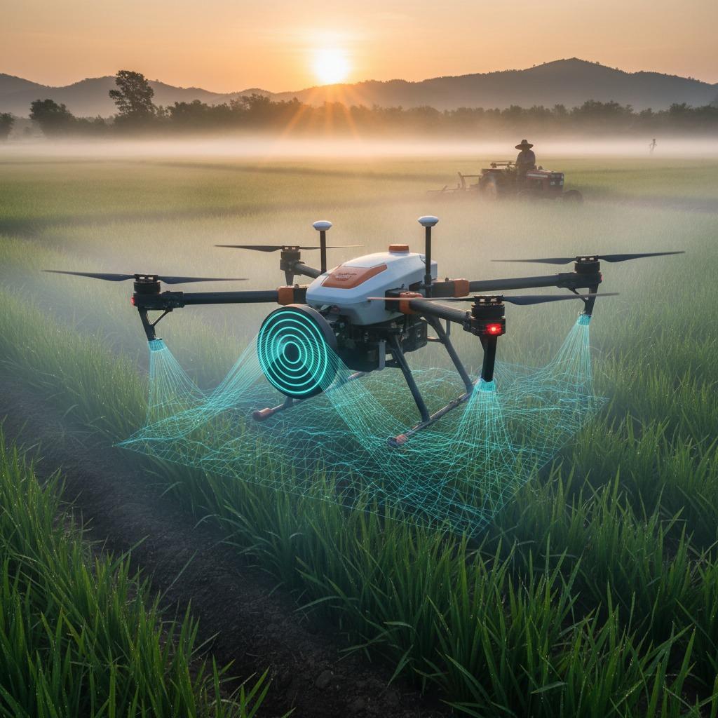
mmWave radar uses high-frequency radio waves to create detailed cloud point data of surroundings, making it ideal for radar technology in farming. Unlike traditional sensors, it penetrates weather challenges, providing reliable data for remote sensing in agriculture. For instance, when equipped on spraying drones, mmWave technology in agriculture allows for precise mapping of fields, identifying crop density and terrain variations. To implement this, start by selecting a drone compatible with mmWave modules. Next, calibrate the radar during setup to align with GPS systems, ensuring autonomous flights avoid collisions. This step-by-step integration minimizes downtime and enhances operational safety.
Step-by-Step Guide to Deploying mmWave-Equipped Spraying Drones
Begin with planning your mission using agricultural spraying drones. Load the drone with the appropriate payload—fertilizers or pesticides—and program flight paths via software that incorporates mmWave radar data. The radar scans ahead, detecting obstacles like trees or power lines in real-time, allowing the drone to adjust its route dynamically. For crop management drones, configure the system to monitor soil moisture and plant health during flights. Test in a small area first: launch the drone, observe radar feedback on a connected app, and refine settings for optimal spray distribution. This approach ensures even coverage, reducing chemical overuse by up to 30% compared to manual methods.
Leveraging Drones for Precision Agriculture Technology
Incorporating drones for agriculture with mmWave radar elevates remote sensing in agriculture to new heights. These systems collect data on crop growth stages, enabling targeted interventions that align with precision agriculture technology principles. For larger operations, deploy multiple agricultural UAVs in a swarm, coordinated via central software that processes radar inputs for synchronized spraying. Maintenance is straightforward: regularly update firmware to improve radar accuracy and clean sensors after each use to prevent residue buildup. By following these guidelines, farmers can achieve sustainable practices, cutting costs and environmental impact while increasing productivity.
Benefits and Future of Radar Technology in Farming
The advantages of mmWave radar in spraying drones extend beyond navigation. It supports detailed analytics for crop management drones, such as yield predictions based on real-time field scans. In diverse terrains, from vineyards to orchards, this technology ensures drones for agriculture operate efficiently without human intervention. Looking ahead, mmWave technology in agriculture will integrate with AI for even smarter decision-making, like automatically adjusting spray rates based on detected pest levels. To get started, invest in compatible hardware and training—many platforms offer tutorials on integrating radar with existing UAV systems. Embracing these tools positions your farm at the forefront of innovative, data-driven farming.
As we introduce next-generation agricultural drones, equipped with multiple rotors for stability and a sophisticated spraying system for optimal coverage, the fusion of mmWave radar revolutionizes how we approach field operations. This high-performance solution dispenses inputs precisely, minimizing waste through integrated GPS and sensor systems that deliver real-time insights into crop health and soil conditions. Whether managing vast farmlands or smaller plots, this aerial tool maximizes productivity and sustainability, making advanced farming accessible and effective.