

Blog List
Home
Blog List

Build trust, loyalty, and profitable relationships with global audiences with Linpowave.

1. Overcoming Challenges in Drone Velocity Measurement 2. The Core Problem: Inaccurate Speed Detection 3. Advanced Solutions with 4D mmWave Radar 4. Spotlight on LINPOWAVE U300 5. Implementing Radar Solutions for Future-Proof Operation
 Ningbo Linpowave
1. Overcoming Altitude Challenges in Drones 2. The Core Problem: Inaccurate Altitude Detection 3. Terrain Following UAV Radar for Seamless Navigation 4. mmWave Radar Altitude Measurement for High Precision 5. Precision UAV Landing Sensor: Ensuring Safe Touchdowns 6. Advanced Applications: Drone Topography Mapping and Beyond 7. Conclusion: Solving Unreliable Height Control
Ningbo Linpowave
1. The Challenge of Obstacle Detection in Drone Operations 2. How mmWave Radar Addresses UAV Collision Risks 3. Enhancing Navigation with Advanced 4D Radar Capabilities 4. Empowering Autonomous Sensing and Environment Mapping 5. Spotlight on Linpowave U300: A Leading mmWave Solution
Ningbo Linpowave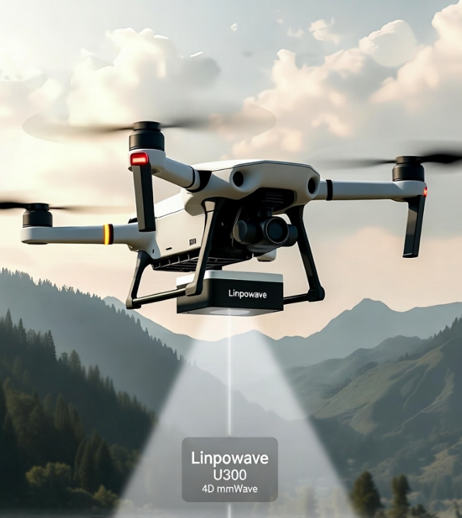
Linpowave’s U300 4D mmWave radar enables drones to detect obstacles, track moving objects, follow terrain, and land safely even in fog, rain, or darkness.
Ningbo Linpowave